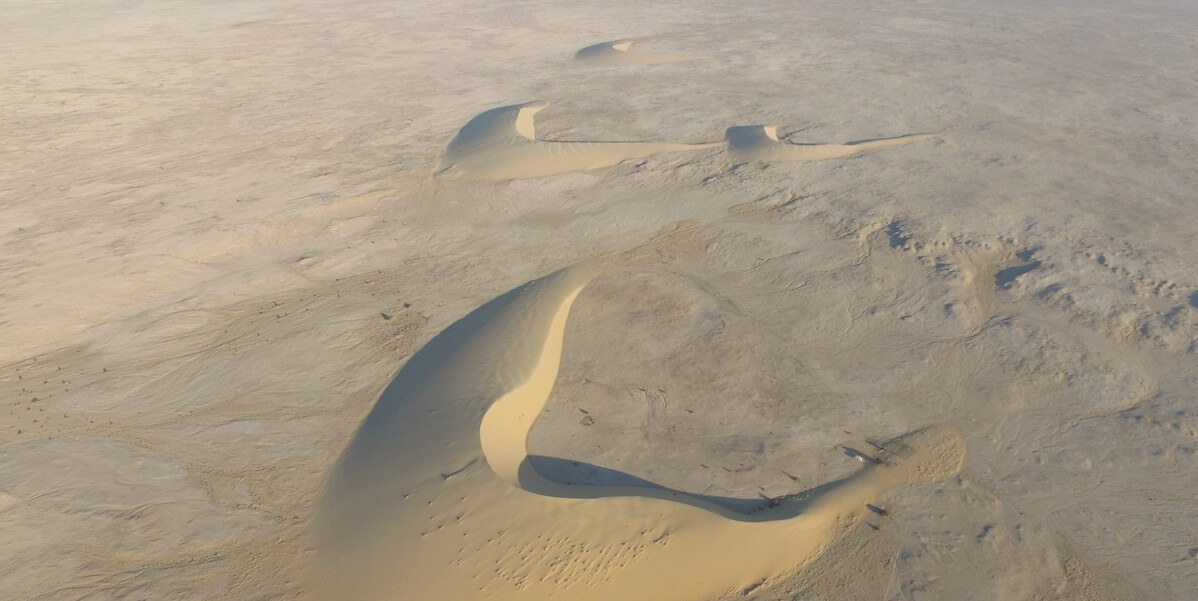
 Water shortages are expanding across the Earth. This is particularly acute in desert areas of the Middle East that are subject to both drought and extreme conditions such as flooding. As a result of these uncertainties, there is an increasing reliance on shallow aquifers to mitigate these shortages. However, the characteristics of these aquifers remain poorly understood due to the reliance on sporadic well logs for their management.
To address this challenge a team of researchers at the USC Viterbi School of Engineering Ming Hsieh Department of Electrical and Computer Engineering along with collaborators at Metric Systems Corporation, Caltech, Institute of Flight System Dynamics at the Technical University of Munich, the Department of Electrical Engineering at Qatar University, the Qatar Environment and Energy Research Institute at Hamad Bin Khalifa University, Bin Omran Trading & Telecommunications, the Earth and Life Institute at Catholic University of Louvain, the Department of Civil and Environmental Engineering at University of Hawai’i at Manoa, and The Aerospace Corporation, developed a new prototype for what the team is calling an “Airborne Sounding Radar for Desert Subsurface Exploration of Aquifers,” nicknamed “Desert-SEA.” The new technique will map the top of the aquifer, called the “water table,” spanning areas as large as hundreds of kilometers using a radar mounted on a high-altitude aircraft. According to the researchers, Desert-SEA will measure, for the first time, the variabilities in the depth of the water table on a large scale, allowing water scientists to assess the sustainability of these aquifers without the limitations associated with in-situ mapping in harsh and inaccessible environments.
“Understanding how shallow groundwater moves horizontally and vertically is our primary objective as it helps us answer several questions about its origin and evolution in the vast and harsh deserts. These are questions that remain unanswered to this day,” says Heggy, a research scientist at USC who specializes in radar remote sensing of deserts and the lead author of the paper outlining the technology in IEEE-Geoscience Remote Sensing magazine.
How it works:
The technique uses low-frequency radar to probe the ground. The radar sends a series of pulsed waves into the ground, which are reflected when interacting with the water-saturated layer. From the reflected signal, and using an array of advanced antennas combined with computational techniques, the water table can be mapped with relatively high vertical and spatial resolution.
When imaged, a stable water table usually appears as flat reflector as the amounts of water withdrawn and the amount of water that enters the system (its “recharge”) are nearly equal. However, if there is any imbalance, this will be reflected in the resulting image showing an upward or downward deflection in shape of the water table.
A similar technique is widely used for probing ice in the Antarctic and planetary bodies; however, adapting it to sense shallow aquifers in the deserts required resolving several challenges in the radar design that took three years of hard work with industry partners in Carlsbad, CA, to resolve it.
“In particular, we had to resolve the blind zone near the surface. The highly radar-attenuating ground, unquantified sources of noise, and complex clutter can mask the detection of shallow aquifers. Our system’s probing and surveying capabilities surpass those of commercial ground penetrating radars, whether surface or drone-mounted. Our system transmits stronger signals, has more sensitive receivers, and operates faster by several orders of magnitude,” says Heggy.
Current shallow groundwater maps in several parts of arid deserts, such as the Sahara, rely on data from wells that are tens, hundreds, and sometimes even thousands of miles apart, which could lead to inaccurate estimates of their volume and dynamics. Heggy suggests that this would be like finding out data about groundwater in the entire United States solely by looking at data from a well in New Jersey. (The desert area of North Africa and the Arabian Peninsula is twice the size of the continental United States). Thus, well logs alone cannot give a proper assessment of their rapid evolution, cautions Heggy.
According to the researchers, Desert-SEA’s capability to transmit high-power signals and use advanced onboard processing can fill the gaps in the data presented by well logs’ geographical distribution.
With this new prototype, Heggy predicts that even with a small airplane flying at two hundred miles per hour, the team could cover in an hour what researchers would normally cover in a year from well log data.
Co-author Bill Brown was the lead engineer on the project. Brown says, “The Desert Sea Radar represents a significant advancement in airborne sensing and environmental engineering. By integrating high-frequency radar with AI technologies, it can generate real-time, three-dimensional mappings of subterranean water sources. This capability is crucial for securing sustainable water management in arid regions.”
While this technology will be tested in the Middle East, it has wide application to other places that are subject to extended droughts, notably in central Asia and Australia, and even in US deserts.
This technology works best in very dry areas like sand and its particular importance goes beyond understanding the current water supply. It can also be deployed for repeated assessments to understand sustainability for agriculture and, consequently, for ensuring food security for inhabitants of these extreme environments.
“Having the ability to peer more than 100 feet deep through dry sand, across vast deserts and in record time, is going to allow us to answer fundamental questions about the ebb and flow of groundwater in these regions and how we can use it in a more sustainable way,” said Elizabeth Palmer, a Fulbright Fellow working on the project.
“I am always glad to participate in airborne research missions. However, because the Desert-SEA mission will have a humanitarian impact on relieving water stress, it gives me unique feelings of motivation and pride,” Akram Amin Abdellatif, a researcher at the Technical University of Munich (TUM) noted.”
The next step for the research team is to take this designed prototype and build a flight model to be implemented on helicopters and fixed-wing aircraft.
Published on May 16th, 2024
Last updated on May 17th, 2024


